I have a customer that wants 1 of these maps to start, but may order up to 15 of these in up to a 24"x36" size.
If this violates rules here pls let me know. I feel like many of us just try to make a little dough to buy materials, and the next “maker” toy, and this could buy you some serious toys…
send me an email; naturally focused 256 … gmail.com
naturally focused 256 * etsy * com is the store, but I am too busy to finish my MPCNC and learn CAM right now.
I can’t help but I just want to say I love these maps you do, I want to do something like that for local areas but haven’t found the time to figure out all the CAD Conversion end. Hopefully you can share a detailed step by step one day.
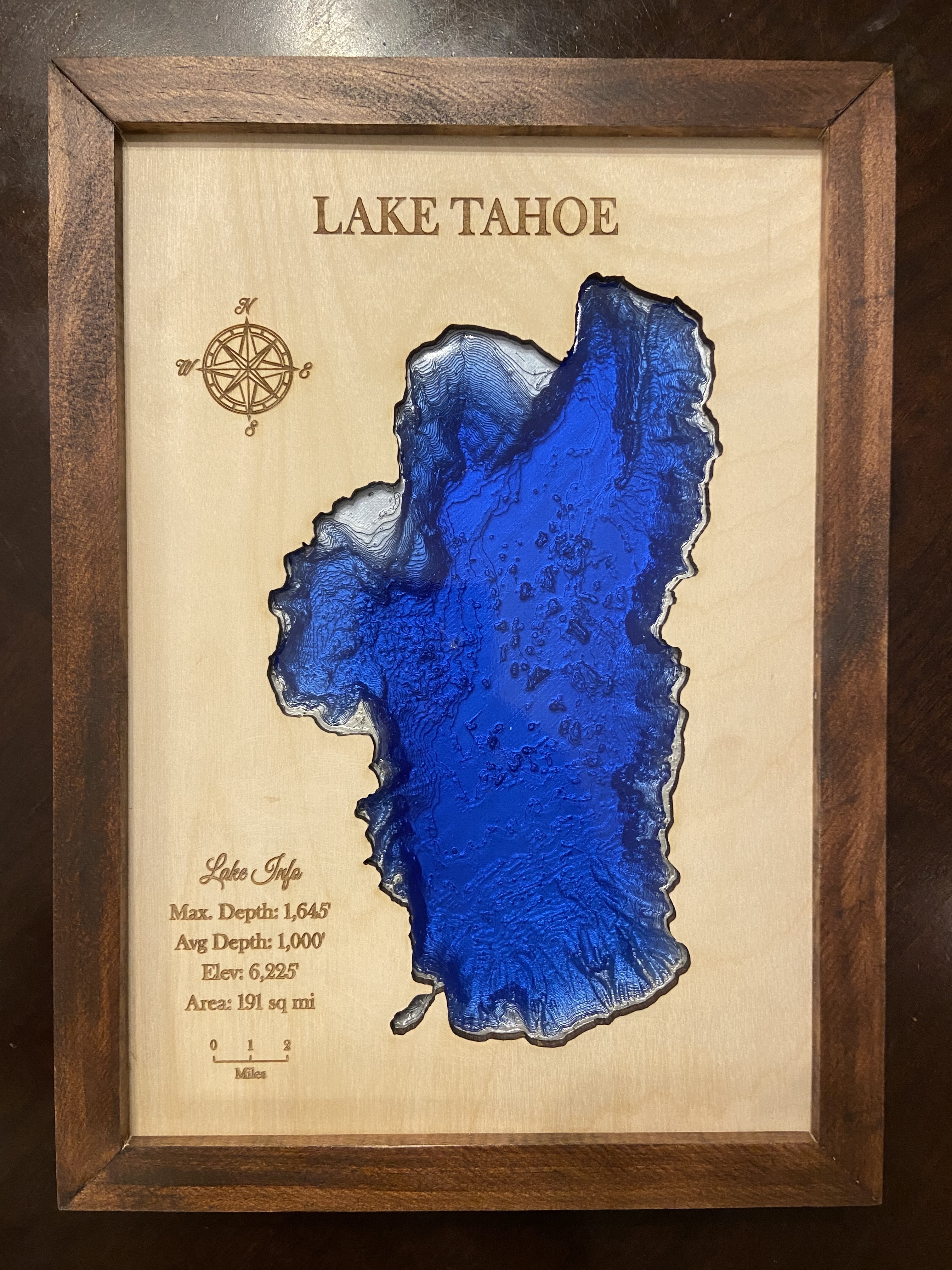
It doesn’t do bathymetry- that requires QGIS. I started with 3d printing mountains last fall, but shorelines look cooler. Now the Grand Canyon 3D print – that was a real trip!
There are plenty of tutorials out there on how to make maps, but as you can imagine, people get in a rush and leave out like all the important parts when they document it. Sooo much time to figure this out on my own, but i taught my wife in a few hours what took me months to learn by sheer effort and will power.
I put the basics in the other thread I posted, but it is mostly about learning GIS, downloading the National Hydrography dataset for the state, filtering to the lake you want, and exporting to PDF, then importing to your vector software (ink space) where the 2D design is drawing. The 2D CAD to make vectors and text is really basic. processing the GIS data and exporting is the steep learning curve.
Edit: But 3D lakes like this are only possible where NOAA has files available. They do have data on all ocean coasts the Great Lakes and some other larger lakes. See my post below on how to make a 3D lake from a 2D contour depth map
And by the way, if you just need the GIS files, i’d be more than happy to help. I can do most anything in minutes. just need a google maps screenshot of what you want in 3D STL or 2D PDF (vector).
That one looks like it’s laser cut and laser engraved with a 3D printed lake. Ok, after looking up bathymetric data I think I understand now. Some are 2D for small lakes that have no bathymetric data, but lakes of sufficient interest and coastlines have bathymetric data so those can be 3D. Very nice work!
Yes. And a happy find is that some states have GIS vector files for 2D depth lines. (They call them contours in GIS world)
I just converted Mille Lacs in Minnesota from 2D contours into a stair stepped 3D model, by creating grey scaled coloring and using the CURA slicer which sets 3D height by grey scale.
So since 24x36 would take something like six to nine 3D prints, I think a large size like this would really be best done by CNC carving.
I am still looking for a source for bathymetry files for all lakes. The data exists. It is not real accurate but gpsnauticalcharts.com uses it
I interned at a company that used a lot of arcGIS. It was definitely more complicated than it feels like it should be. But there is a lot of available data that I would never think about. We had one project where we were taking maps of burn scars and estimating the amount if grass, bush, trees burned, etc. (And then we were estimating the amount of major pollutants from each fire. It was outside of my knowledge, I just took the numbers and simulated a bunch of other fires for air quality planning purposes.)
It was a lot of work just to get the data in the same projections and do all the calculations of intersecting shapes.