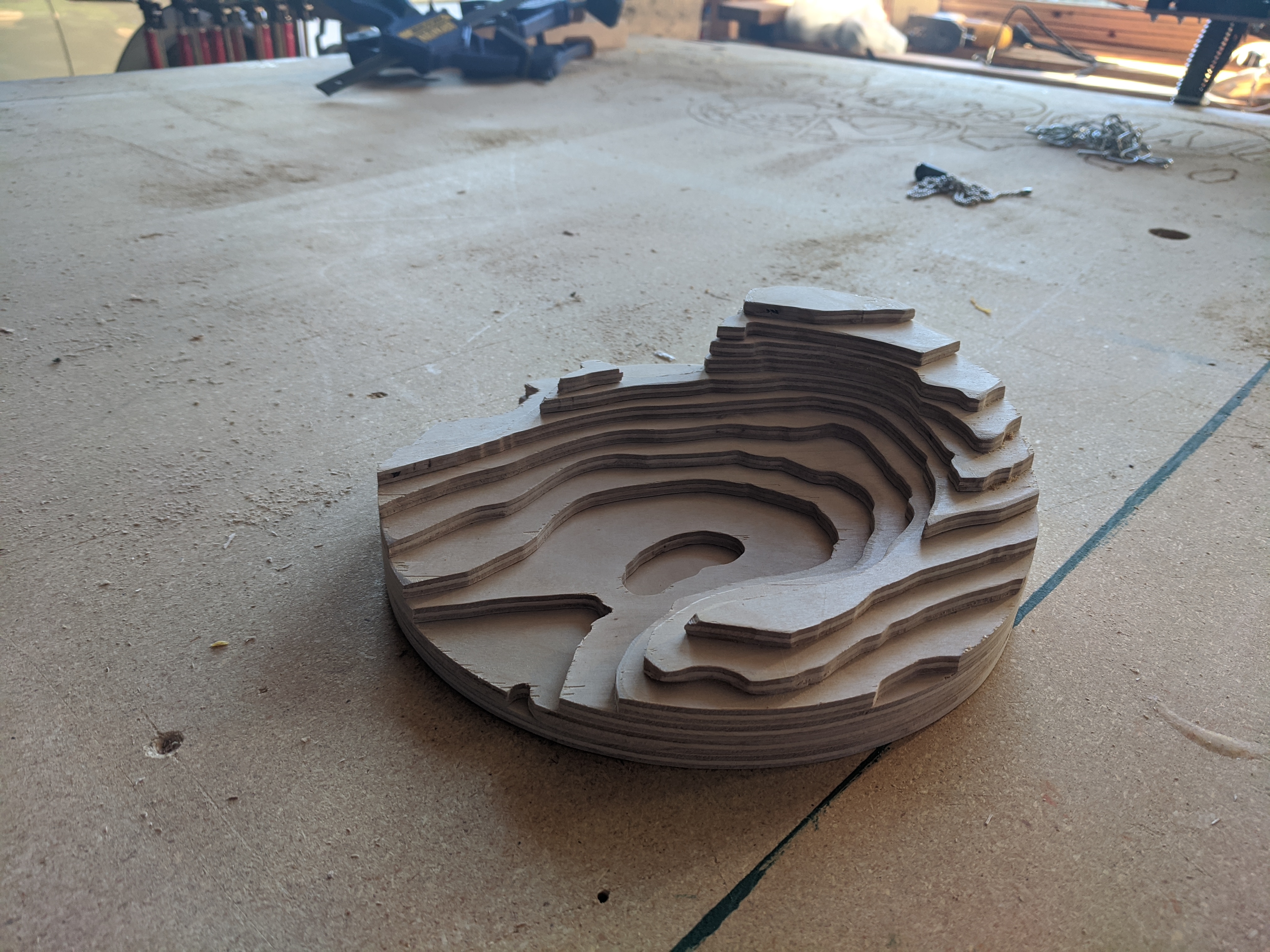
A friend asked if I could help out with a gift. Initially he wanted to hand cut out vinyl using a printed topo map of the area. I asked if I could do it in wood and use a machine. He said yes.
Initially I tried using a geographic data to STL tool (http://jthatch.com/Terrain2STL/) with Fusion 360 Slicer. This would have been ok, but at the scale / resolution I was going for it just looked like blobs with little definition.
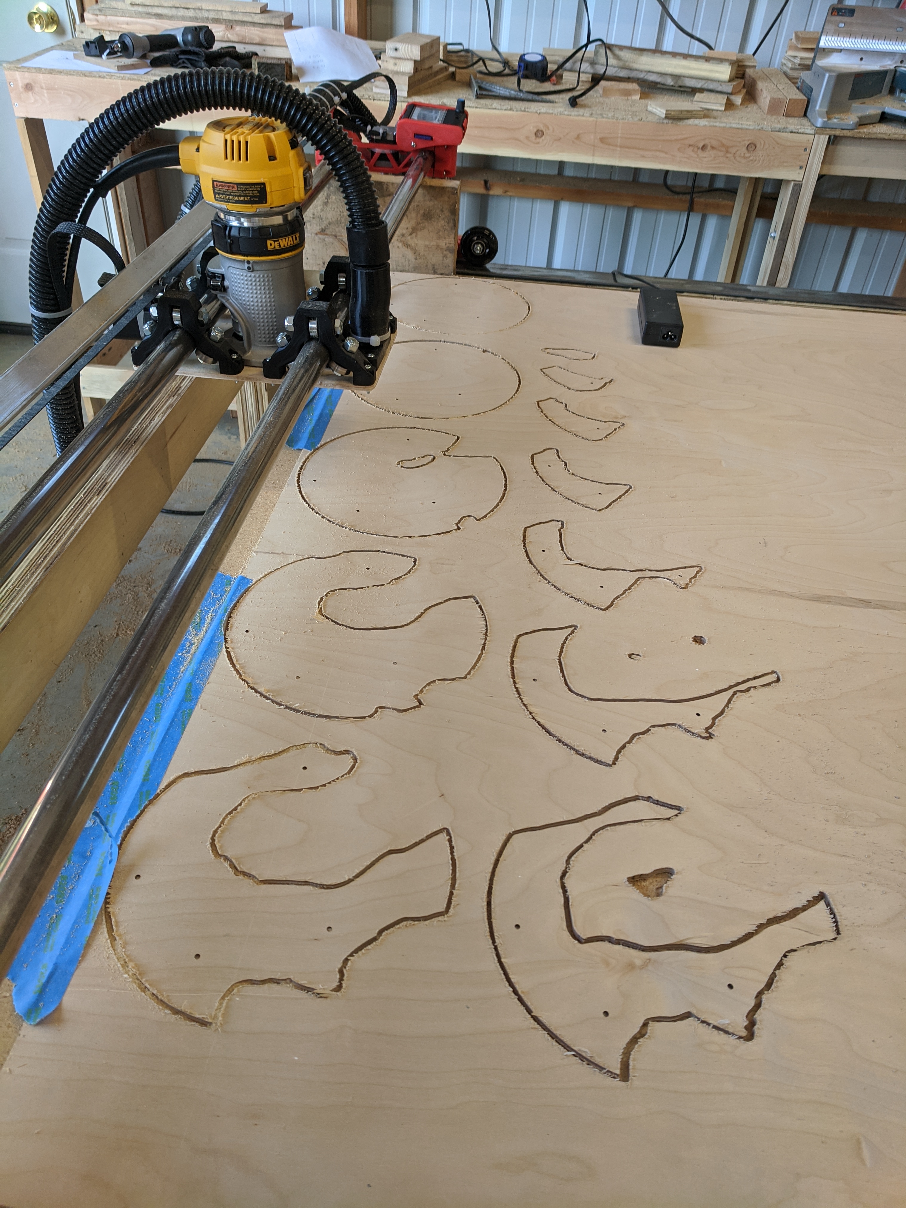
After a couple hours looking for high-resolution data sets, I caved and manually mapped a jpg map to vector in Illustrator. It took a little bit, but gave me the resolution I was looking for.
Some of the smaller bits for the top layer turned out to be too small. I am still trying to get my head around a ‘minimum’ shape for this machine.
I guess this would rely much on the size of mills you use? I recently ordered a few 1 and 0.8mm mills. I’m very curious to see how they perform, I honestly expect them to break just when installing them…
Thanks everyone for the compliments and the suggestions!
I am also thinking not cutting all the way through on the smaller parts, just scoring the top surface, then cutting them out by hand / cleaning up after. I was using tabs, but they were not much help at that small scale.